UN
9 Pleasant Grove
£ 77,500
Description
We don't have a Description for this property.
- Bedrooms
- 1
- Bathrooms
- 0
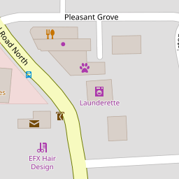

Leaflet © OpenStreetMap contributors
The heatmap indicates the level of crime in the area. The color of the heatmap indicates the crime severity and recency.
Metrics Year-on-Year
- Average area value
- 188,142.00 £Increased by 2.93 %
- Average area rental value
- 524.00 £/moDecreased by 29.38 %
- Est rental Yield
- 3.34 %Decreased by 31.42 %
- Crime Rate
- 10.00 %Unchanged by 0.00 %
from 182,786.00 £
from 742.00 £/mo
from 4.87 %
from 10.00 %
Nearby Schools
| Name | Type | Ofsted | Distance |
|---|---|---|---|
| Sacred Heart Catholic Primary School, Thornton Cleveleys | Voluntary Aided School | Good | 0.68 KM |
| Great Arley School | Community Special School | Good | 0.75 KM |
| Thornton Cleveleys Royles Brook Primary School | Community School | Good | 0.82 KM |
| Thornton-Cleveleys Red Marsh School | Community Special School | Outstanding | 0.84 KM |
| Thornton Primary School | Community School | Good | 1.00 KM |
Images
Nearby Streets
| Name | Average Price | Average Sqft | Distance |
|---|---|---|---|
| Mill Close | £ 174,975 | 0 | 0.00 KM |
| Millfield Court | £ 0 | 0 | 0.00 KM |
| Ferndale Close | £ 185,000 | 0 | 0.00 KM |
| Patten Place | £ 165,000 | 0 | 0.00 KM |
| Alder Close | £ 0 | 0 | 0.00 KM |
Nearby Transport
| Name | NLC | TLC | Distance |
|---|---|---|---|
| Poulton-Le-Fylde | 2671 | PFY | 3.72 KM |
| Layton (Lancs) | 2669 | LAY | 4.92 KM |
| Blackpool North | 2739 | BPN | 7.29 KM |
| Blackpool South | 2740 | BPS | 9.49 KM |
Nearby Listings
| Address | Price | Type | Score | Distance |
|---|---|---|---|---|
| PLEASANT GROVE - THORNTON CLEVELEYS - FY5 4AG | £ 350,000 | BUY | 7 / 10 | 0.00 KM |
| Woodland Avenue, Thornton-Cleveleys | £ 190,000 | BUY | 7 / 10 | 0.05 KM |
| FLEETWOOD ROAD NORTH - THORNTON CLEVELEYS - FY5 4AE | £ 149,950 | BUY | 7 / 10 | 0.05 KM |
| Devonshire Avenue, Thornton, FY5 | £ 150,000 | BUY | 6 / 10 | 0.14 KM |
| Woodland Avenue, Thornton Cleveleys | £ 165,000 | BUY | 6 / 10 | 0.15 KM |
Nearby Properties
| Address | Price | Distance |
|---|---|---|
| 9 Pleasant Grove | £ 77,500 | 0.00 KM |
| 6 Pleasant Grove | £ 90,000 | 0.00 KM |
| 11 Pleasant Grove | £ 58,000 | 0.00 KM |
| 8 Pleasant Grove | £ 78,000 | 0.00 KM |
| 10 Pleasant Grove | £ 64,000 | 0.00 KM |